UN
38 Lanthorne Road
£ 950,000
Description
We don't have a Description for this property.
- Bedrooms
- 5
- Bathrooms
- 0
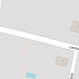
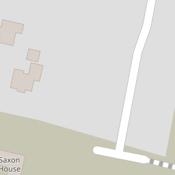

Leaflet © OpenStreetMap contributors
The heatmap indicates the level of crime in the area. The color of the heatmap indicates the crime severity and recency.
Metrics Year-on-Year
- Average area value
- 477,998.00 £Increased by 20.59 %
- Average area rental value
- 1,123.00 £/moDecreased by 19.21 %
- Est rental Yield
- 2.82 %Decreased by 33.02 %
- Crime Rate
- 1.00 %Unchanged by 0.00 %
from 396,381.00 £
from 1,390.00 £/mo
from 4.21 %
from 1.00 %
Nearby Schools
| Name | Type | Ofsted | Distance |
|---|---|---|---|
| Stone Bay School | Foundation Special School | Good | 0.79 KM |
| St Peter-In-Thanet Cofe Junior School | Voluntary Aided School | Good | 0.93 KM |
| St Joseph'S Catholic Primary School, Broadstairs | Academy Converter | Good | 1.04 KM |
| Callis Grange Nursery And Infant School | Community School | Outstanding | 1.07 KM |
| Callis Grange Children'S Centre | Children's Centre | 1.20 KM |
Images
Nearby Streets
| Name | Average Price | Average Sqft | Distance |
|---|---|---|---|
| Kings Avenue | £ 0 | 0 | 0.00 KM |
| Lyndhurst Road | £ 749,973 | 0 | 0.00 KM |
| Stanley Road | £ 465,825 | 0 | 0.00 KM |
| King's Avenue | £ 560,333 | 0 | 0.00 KM |
| Queen's Avenue | £ 513,889 | 0 | 0.00 KM |
Nearby Transport
| Name | NLC | TLC | Distance |
|---|---|---|---|
| Broadstairs | 5006 | BSR | 1.11 KM |
| Dumpton Park | 5034 | DMP | 2.98 KM |
| Ramsgate | 5023 | RAM | 4.71 KM |
| Margate | 5018 | MAR | 7.44 KM |
Nearby Listings
| Address | Price | Type | Score | Distance |
|---|---|---|---|---|
| Lanthorne Road, Broadstairs, Kent | £ 1,250,000 | BUY | 6 / 10 | 0.06 KM |
| Radley Close, Broadstairs, CT10 | £ 450,000 | BUY | Unknown | 0.14 KM |
| Tina Gardens, Broadstairs, CT10 | £ 459,995 | BUY | 7 / 10 | 0.20 KM |
| Radley Close, Broadstairs | £ 575,000 | BUY | 6 / 10 | 0.21 KM |
| Radley Close, Broadstairs, CT10 | £ 425,000 | BUY | Unknown | 0.22 KM |
Nearby Properties
| Address | Price | Distance |
|---|---|---|
| 24 Lanthorne Road | £ 363,000 | 0.00 KM |
| 38 Lanthorne Road | £ 950,000 | 0.00 KM |
| 28 Lanthorne Road | £ 325,000 | 0.02 KM |
| 22 Lanthorne Road | £ 218,000 | 0.02 KM |
| 32 Lanthorne Road | £ 321,000 | 0.05 KM |